I find when I am out getting photos for our Photography Group projects it is as much about exploring as the photos themselves.
I spent part of the past weekend with a friend driving through regions of Hunterdon I don’t normally visit looking for barns, bridges and buildings and anything else that caught my eye and called out for a photo. I found a lot of things to shoot.
I’ve been doing this a lot lately, not just in Hunterdon, but in other areas of NJ and PA. It’s always fun and I frequently come across unexpected finds and meet interesting people. This weekend was no different.
Some of my photos are possible project photos but many of them are just “hey that’s cool” photos. Some of my favorites are shots of kids playing in the river. I shoulda jumped in with them.
The weekend excursion was also a good opportunity to practice geo locating my images using Google Map and getting samples for the upcoming workshop “Geotagging and Google Maps.” At each location I took a project photo, I dropped a pin to record the location.
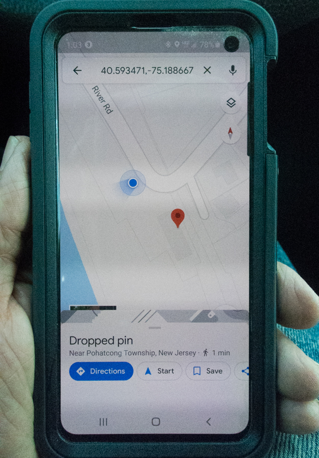
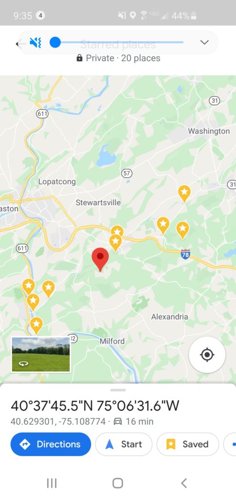
Over the course of the trip I dropped about 20 pins which will help me determine the locations of the photos later.
As I take the photos I think I will remember where I took them. I know what road I am on and stuff, but I always forget. This method really helps. The pins are a permanent record and are easy to create and use.
A couple of times I also took a shot with my cell phone using Lightroom Mobile and then “shared” the image to Google Map.
This turned out to be weirder than I thought it would be. Instead of Google Map adding my photo to the location I was standing, instead it added it to a nearby business or a school, which are locations that have already been identified on Google Map.
So now the photo collection of an elementary school includes a nearby farm stand and a local business has a photo of a historic building in its collection.
I am looking forward to sharing the methods use for geo locating my photos and some of the things we can do with Google Map in the upcoming workshop, GEOTAGGING AND GOOGLE MAP
Two sessions are planned. One for Saturday morning, July 25 at 10:00 and the other for Monday, July 27 at noon. Special discounted rates for Project Photographers!
Have you found yourself shooting things that would be good for the archive, but you have no idea what it is that you photographed and/or it’s historical significance?
Historical significance is secondary. Just identify the location; road and twp.
I wish I had the luxury of driving around Hunterdon but since I don’t know the area, it would a frustrating exercise. Due to distance, my scouting has been limited to Google Maps overviews of East Amwell and West Amwell.